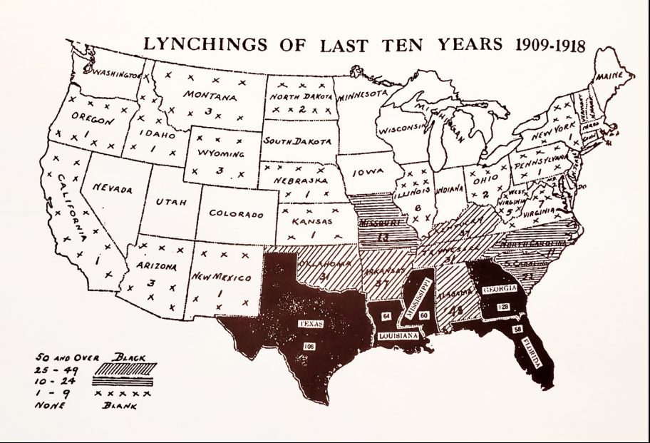
An early 20th-century NAACP map showing lynchings between 1909 and 1918. The maps were sent to politicians and newspapers in an effort to spur legislation protecting Black Americans. Library of Congress
An early 20th-century NAACP map showing lynchings between 1909 and 1918. The maps were sent to politicians and newspapers in an effort to spur legislation protecting Black Americans. Library of Congress
Here are some quick links to NAARC’s website to help you get involved and stay informed:
• Donate
• What is NAARC?
• What is NAARC’s 10 Point Plan?
• Forums & Conferences
• NAARC News
• Reparations Advocate Sign Up
 |
 |
 |
 |
 |

![]()
The Institute of the Black World 21st Century (IBW, IBW21) is committed to enhancing the capacity of Black communities in the U.S. and globally to achieve cultural, social, economic and political equality and an enhanced quality of life for all marginalized people. – Learn more here
© 2025 Institute of the Black World 21st Century.